Long distance trails
Discover our best long-distance hiking trails.
Wiltz National Walking Trail
Distance : 17 km
Level : Moderate
Start : Place des Martyrs in Wiltz
As the capital of the Ardennes, Wiltz is the ideal starting point for this multi-faceted hike. The path winds through a magnificent landscape, crossed by the Wiltz valley, and offers magnificent views, particularly in the village of Nocher, located in the heights of the Ardennes. Halfway along the route, you can stop off in Kautenbach. As the hub of the national hiking trails network, this town offers interesting possibilities for discovering the Luxembourg Ardennes on foot. The walk ends at Goebelsmuehle, from where you can easily reach Wiltz by train.
Charles Mathieu Walking Trail
Distance : 42 km
Level : Difficult
Start : Garden Square in Esch-sur-Sûre
Built in honour of Charles Mathieu (1863-1933) – former deputy and mayor of the town of Wiltz – this hiking trail allows you to explore the heart of the Luxembourg Ardennes. Visit the tourist highlights of Esch-sur-Sûre, Wiltz and Vianden, while discovering other spectacular sites along the way. Located near Hoscheid, the "Molberlay" will remind you of an alpine hike while offering you unforgettable views.
Escapardenne: Hidden Landscapes Loop

This hiking loop covers an area very popular with hikers: the Luxembourg Ardennes between Clervaux, Kautenbach and Wiltz. The route from Wiltz to Clervaux via the western part of the Eislek allows you to discover a little-known region hidden from view, where magnificent landscapes are revealed with every step you take.
Four days of hiking
80 km
This route is not signposted. You will therefore need to find your way using a map or your smartphone.
Stage 1 : Kautenbach - Wiltz
Distance : 16 km
Level : Moderate
Start : Kautenbach Train Station
Starting in Kautenbach, this stage begins with a short climb to the village of Merkholtz. The loop follows the Wiltz valley, which is the main river in North Eislek. At the end of the first stage is the town of Wiltz, also known as the "capital of the Ardennes".
Stage 2 : Wiltz - Derenbach
Distance : 18,5 km
Level : Moderate
Start : Near the church in Niederwiltz
This route starts with a steep climb towards Noertrange. You will then walk along the public Way of the Cross, which leads to the shrine of Our Lady of Fatima. Upstream of Wiltz, the loop, passing through authentic villages, continues to wind its way up the valley towards Bastogne.
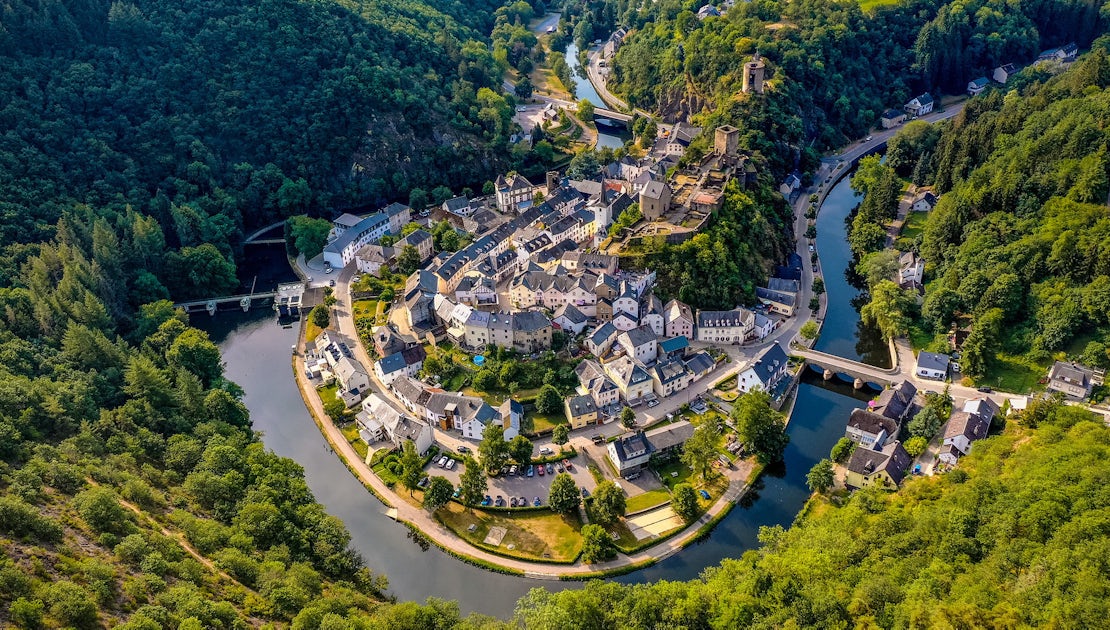
Stage 3 : Derenbach - Clervaux
Distance : 20,5 km
Level : Difficult
Start : Derenbach
The third stage runs through 15 km of forest in the Wincrange plateau, alternating between coniferous and deciduous forests and romantic valleys that are difficult to access. The loop ends in the town of Clervaux, which is characterised by the spectacular alignment of its medieval castle, its new church and the abbey of Saint Mauritius along the ridge on the convex bank of the Clerve.
Stage 4 : Clervaux - Kautenbach
Distance : 25 km
Level : Difficult
Start : Grand-Rue of Clervaux
The final walk in the Hidden Landscapes Loop leads to the Kiischpelt in the heart of the deep valleys and takes the hiker to the charming village of Lellingen. The village has even been classified as a national monument. The church, surrounded by restored century-old farmhouses, forms the heart of the village. The route ends in Kautenbach.